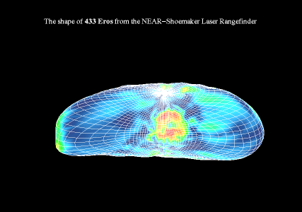
Three-dimensional shape of 433 Eros from the NLR. The mesh represents the scaled shape and the surface facets are color-coded according to the surface slope. (Credit: NLR Science Team)
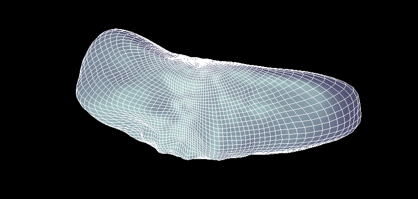
Three-dimensional shape of 433 Eros from the NLR with mesh shaded with an artificial light source. (Credit: NLR Science Team)
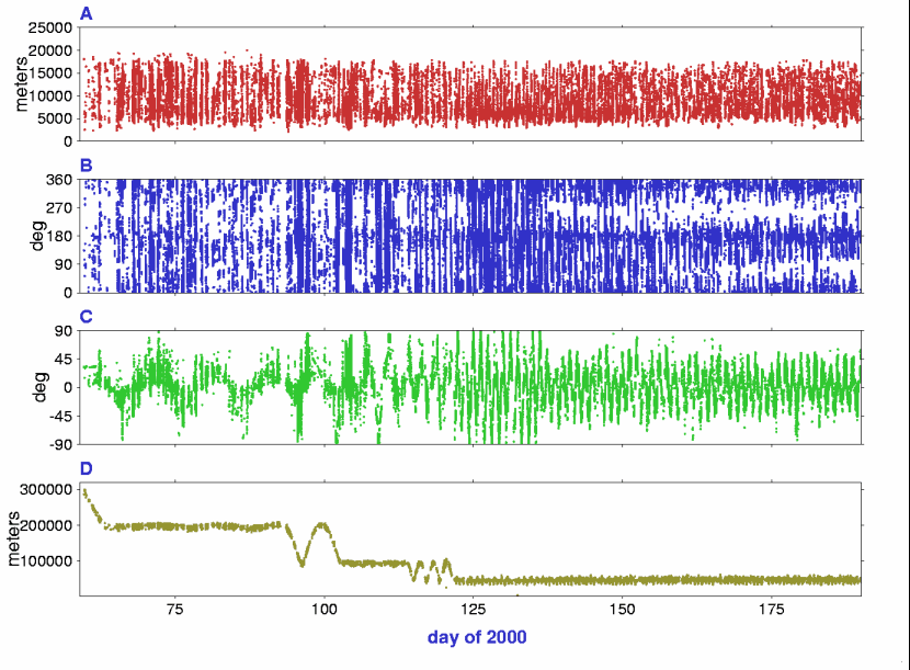
Figure 1. This figure shows a time history of NLR observations of 433 Eros at individual laser bounce used in the analysis. Time runs along the x-axis and corresponds to day of year 2000. (A) radius (B) longitude (C) latitude (D) range from NEAR-Shoemaker spacecraft to the surface of the asteroid. (Credit: NLR Science Team)
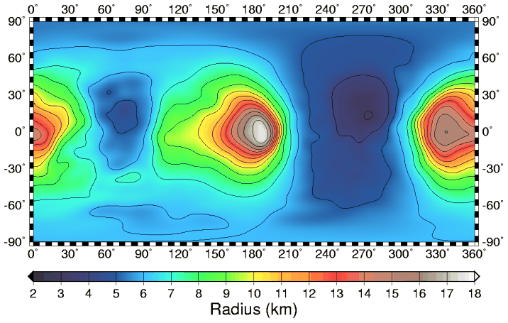
Figure 2. Here is a map view of the radius of Eros in cylindrical projection. This analysis uses a planetocentric coordinate convention with east positive longitude. One degree of latitude on Eros ranges from ~ 54 to 307 m. The regional low at 90° E is Himeros and that at 270° E is Psyche. (Credit: NLR Science Team)
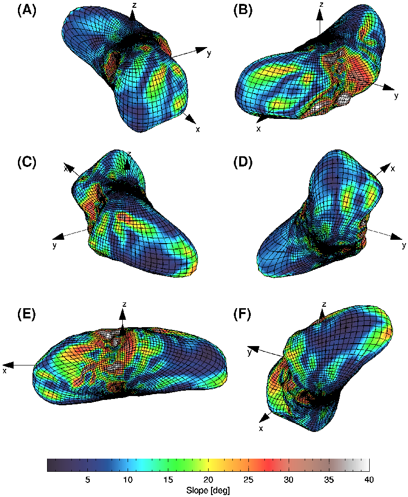
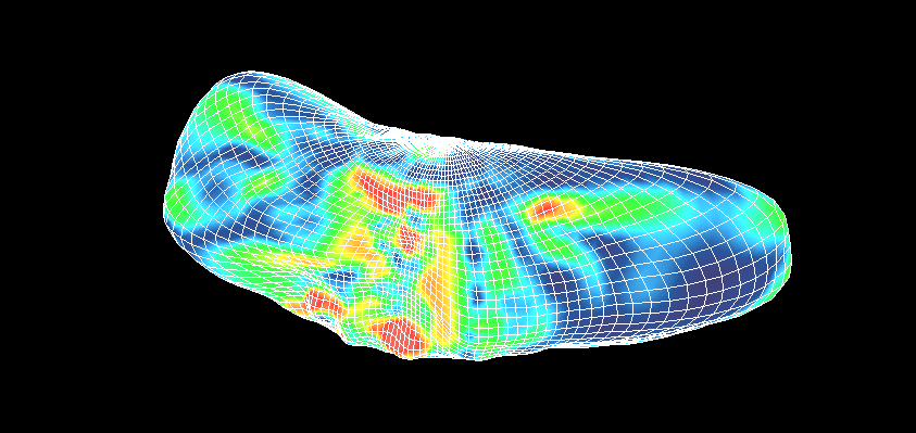
Figure 3. Shown above are six perspective views of a three-dimensional shape model of 433 Eros from the NLR plotted to spherical harmonic degree and order 24. The mesh represents the scaled shape and the surface facets are color-coded according to the surface slope with respect to a constant-density gravity field derived from shape model NLR190. The asteroid is viewed at the following [elevation, azimuth] pairs: (A) 30° N, 330° E (B) 30° N, 30° E, (C) 30° N, 150° E (D) 30° S, 330° E (E) 30° S, 90° E (F) 30° S, 150° E. (Credit: NLR Science Team)
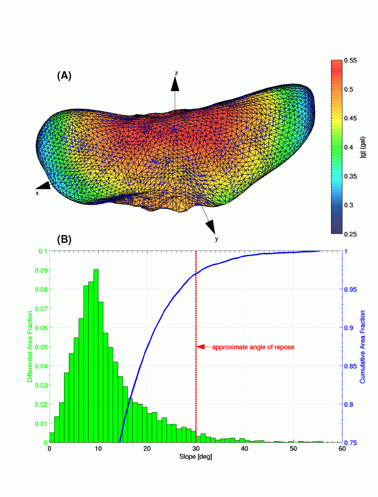
Figure 4. This figure shows vectors that show the directions of gravitational acceleration (g). Units are Gals where 1 Gal = 1 cm/s^2. The asteroid is viewed from 30° N, 60° E. The colors represent the magnitude of g and arrows indicate the direction. (B) Histogram and cumulative frequency distribution of 3¡-baseline surface slopes. On Eros some regions contain clustered slopes above the angle of repose and this indicates that some material near the surface of the asteroid displays structural competence (Credit: NLR Science Team)
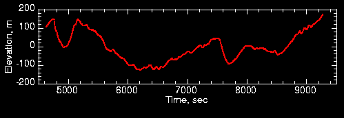
Figure 5. NLR profile of elevation collected on day 116 that shows elevation as a function of time in seconds. A linear trend in the radius has been removed to accentuate small-scale relief. Impact craters can be seen at 4900 s and 7800 s and grooves are visible in the intervals 6000 to 6800 s and 8900 to 9100 s. The vertical exaggeration is approximately 6:1. (Credit: NLR Science Team)
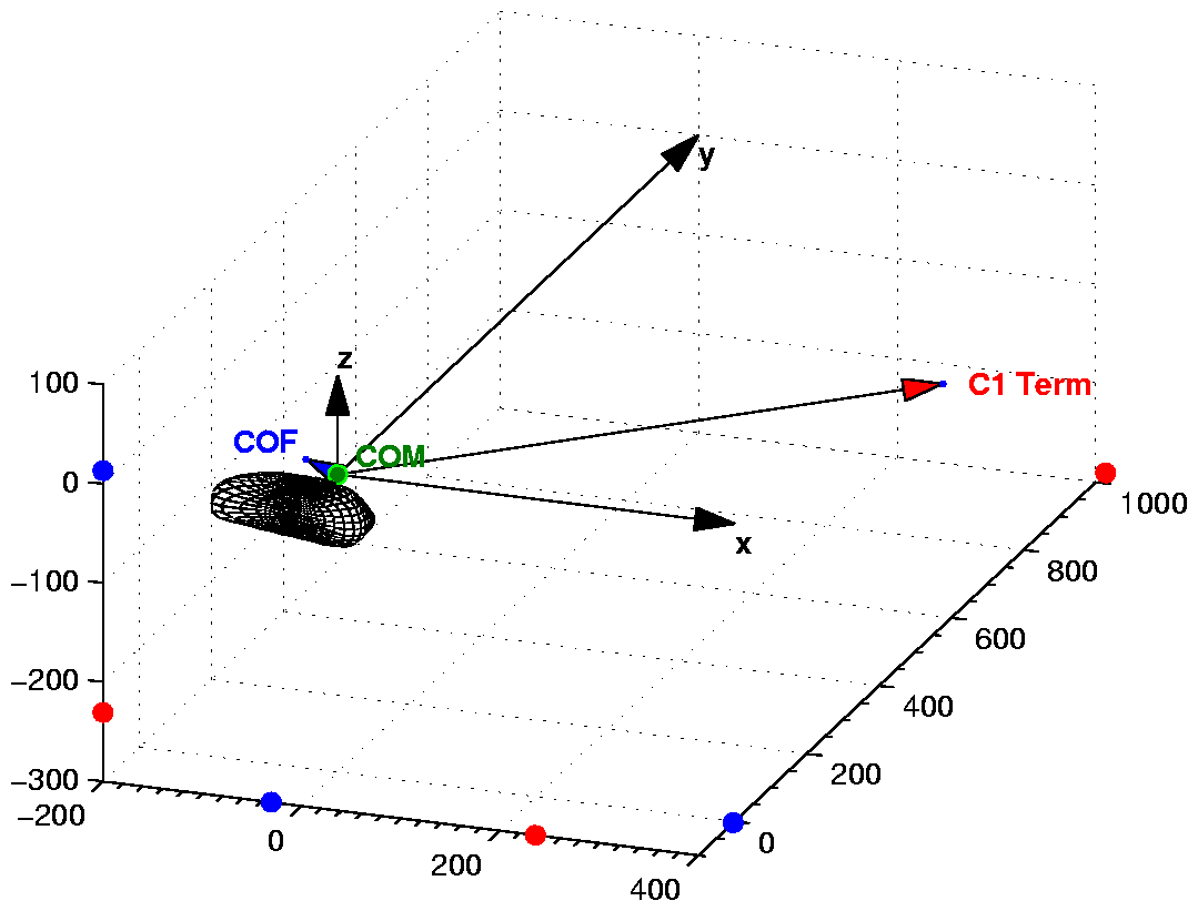
Supplementary Figure 1. Schematic view of the offset of the center of mass and center of figure of Eros, as well as the offset predicted by the C1,0 term of the spherical harmonic representation of the shape model. The offset of the center of mass and center of figure provides information on density variations in the interior. (Credit: NLR Science Team)
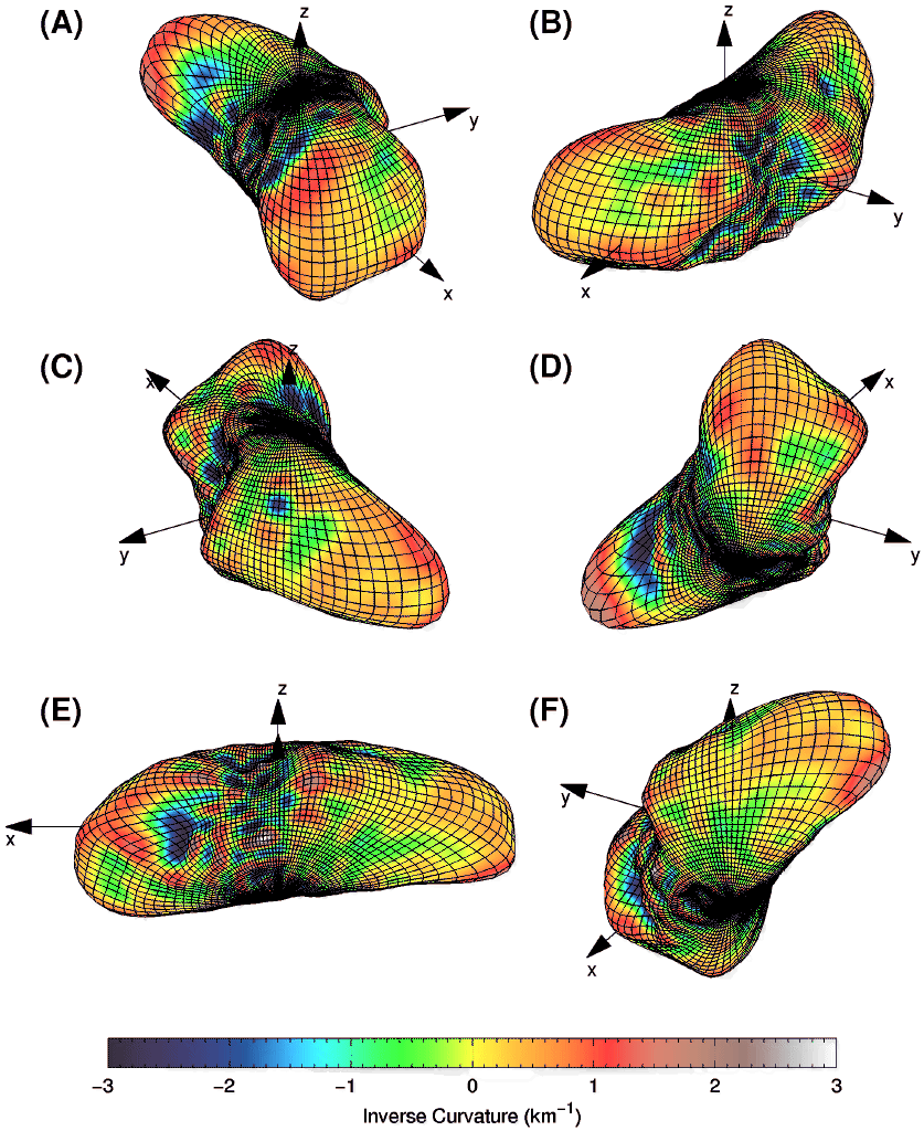
Supplementary Figure 2. Six perspective views of a three-dimensional shape model of 433 Eros from the NLR plotted to spherical harmonic degree and order 24. The mesh represents the scaled shape and the surface facets are color-coded according to the divergence of the surface normal that provides a measure of inverse radii of principal curvature. (Credit NLR Science Team)

Supplementary Fig. 3. High-resolution digital elevation model of a 2-km crater near Eros' north pole constructed from observations obtained during a spacecraft scan on day 110. Note the polygonal cross-section and poorly developed rim. The spatial scale of mesh blocks is 50 m. (Credit: NLR Science Team)
Back to the NEAR-Shoemaker home page
Direct inquiries to: zuber@mit.edu